UNITED MOUNTAIN DEFENSE FIELD WORK PAGE

FIGHTING STRIP MINING FROM THE AIR, FROM THE GROUND AND IN THE WATER!

Thursday, July 28, 2011

Artists: Help support United Mountain Defense!

Open call/public exhibition:

The Mountain Defender, an annual publication of United Mountain Defense, announces a call to artists for public showing and possible publication in our next issue (circulation: 20,000).

We’re looking for 2D work that speaks to our theme, “Breaking the Chains, Building the Future.” This edition will focus on moving beyond dirty energy and looking to a clean energy future in Tennessee. Our publication has a local focus, with a wider regional focus of the Appalachian region. Our mission is to protect Tennessee’s watersheds, air, mountains and people. Particularly, we focus on issues of mountaintop removal coal mining, but we also work on oil, gas and nuclear issues, as well as promote clean energy.

We’d like highly evocative original work in any 2D medium. All submissions will be exhibited at a local gallery in a public showing, and we will hold a public voting for our centerfold, cover and back cover images. We ask that all submissions be received in physical format. If you must submit digitally, please include a $10 submission fee; checks should be written to United Mountain Defense. We encourage artists to donate their work for a public auction fundraiser.

Please adhere to the following dimensions: for consideration for front or back cover, 10 ½” x 11 1/8” with no more than ½” border (photography is encouraged for front cover). For
consideration for centerfold, 21” by 11 1/8” with no more than ½” border. 

Deadline: August 31

To submit, please contact Holly Haworth to schedule a drop‐off. She can be reached at Olmountaingal (AT) gmail.com or (865) 266.9376. You may also call or e.mail with questions.

Visit us at unitedmountaindefense.org

Monday, March 15, 2010

Claiborne County field scout Mar 14 2010

http://www.youtube.com/watch?v=esBtOjvwgec

n 36 30 47.6 w 083 56 22.9


View Larger Map

n 36 30 55.8 w 83 56 07.8

http://maps.google.com/maps?f=q&source=s_q&hl=en&geocode=&q=+n+36+30+55.8+w+83+56+07.8&mrt=all&sll=36.511844,-83.942749&sspn=0.008589,0.01929&layer=t&ie=UTF8&t=h&z=14

Monday, January 26, 2009

Jan 23 2009 scout


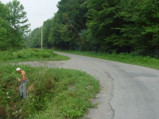
Hey the four photos I am sending you I took Saturday above clear fork near Eagan. One pic is of the sign right beneath it. Its an orange stream going across the road with out a culvert. At the very least I don't think it should be crossing the surface of the road--being bright orange isn't pretty either.

http://i415.photobucket.com/albums/pp232/christopherscottirwin/DSC01820.jpg


http://i415.photobucket.com/albums/pp232/christopherscottirwin/DSC01821.jpg

http://i415.photobucket.com/albums/pp232/christopherscottirwin/DSC01822.jpg


Its above this sign on the gravel road right above mile marker 17.

http://i415.photobucket.com/albums/pp232/christopherscottirwin/DSC01824.jpg


Here are the youtube videos from the Jan 23 UMD ground scout of Claiborne, Campbell, Scott, Anderson and Roane Counties.


http://www.youtube.com/watch?v=Bhtk1vD5O3g


http://www.youtube.com/watch?v=Ixua5AtY8RE


http://www.youtube.com/watch?v=CXvlE82I1is

Sunday, April 20, 2008

April 15th 2008 flyover


These are the pictures from our April 15th 2008 flyover with Southwings.

Saturday, April 12, 2008

April 12th flyover


This is the link to the Flyover of Zeb Mountain and the Tackett Creek Watershed/King Mountain being mined by Mountain Side Coal.

http://april122008flyover.blogspot.com/

Monday, March 24, 2008

March 22nd Claiborne and New River Scout


http://www.flickr.com/photos/10764313@N05/sets/72157604232182434/show/

This is mostly mountainside coal destruction. In the next few days I will tag them with GIS cooridinates.

http://www.flickr.com/photos/10764313@N05/sets/72157604232182434/show/

And

http://www.theartcompound.com/images/earth%20first/photos%20and%20samples%203.28.08/index.htm

http://www.theartcompound.com/events.html

Saturday, February 10, 2007

United Mountain Defense

Tuesday, September 26, 2006

JULY 12TH PAGE

This is the report from the July 12th scout that got misplaced. Added Sept 22. Tap this.

Saturday, July 29, 2006

July 13th field work

July 13th field work!

Field Data: Scouting and Water Testing in New River Watershed
July 13, 2006 We are now up to 7 bright orange streams we have found loaded with at times deadly levels of iron. Tap this.

Friday, July 21, 2006

July 11th field work page 2006 New River Scout!

July 11th 2006 New River Scout!


This is the latest scout! Goto the right or click right here. This beaver dam is
in the New River watershed. Don't worry, we have bright orange streams on this page as well. Thanks to all our hard core volunteers who are doing the scouting, testing, and posting of all this data. Thank you TN Mountain Justice Summer!

Tuesday, July 18, 2006

July 9th 2006 New River Scout

Newest Scout of the New River Watershed! July 9th 2006. We have now found 6 bright orange streams.

Wednesday, July 05, 2006

Newest Field reports June 21, 22

United Mountain Defense just completed results from the June 21st and June 22nd water testing ground scout of strip mines and the areas effected! So far on both days some pics and field data have been posted--over 18 streams were scouted and tested. More coming on a daily basis. Look to your right and tap JUNE 21 or JUNE 22 field pages.

Monday, June 12, 2006

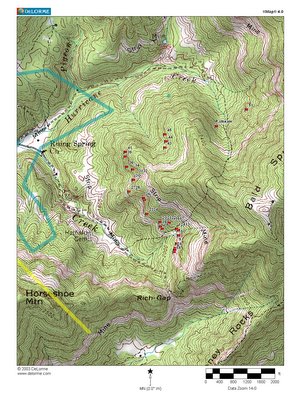
10 mile sample map

Monday, May 01, 2006

April 25 2006 Eagan Scout NEW!

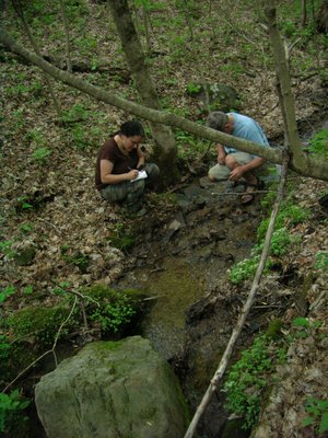
New Scout! This is the scouting trip of the Eagan Quad in Claiborne County in Tennessee. This is a work in progress along with April 26 and 27 (below). Tap this to goto the page. Data will be added to this and the other pages in the next few days. In this picture is UMD Co-Founder Paloma Galindo taking notes for Dr. David A. Etnier. Dr. Etnier is Professor Emeritus of the Department of Ecology and Evolutionary Biology, Dr. Etnier is responsible for starting one of the largest collections of freshwater and marine fish with over 300,000 species. He started the collection in 1966 and says it is in the top 20 in North America.

Thursday, April 27, 2006

Eagan Scout April 27 2006 NEW!

All the pictures on this page are from hiking several miles of the 10 mile long strip mine proposed. Indiana bat habitat is being clearcut in advance of the mining permit. Tap this to see the April 27 report. FYI this like all the recent scouts are works in progress. By this I mean that the first day we upload the photos, the second day we upload notes--then we test water samples from streams in the photos and post those results.

Wednesday, April 26, 2006

APRIL 26 2006 EAGAN SCOUT

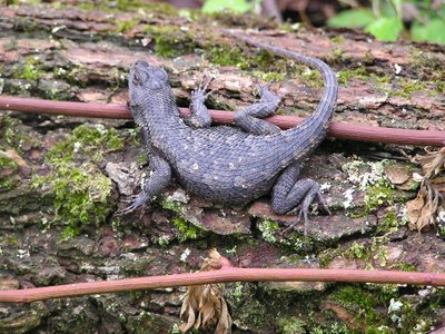
Northern Fence Lizard I found

This is the central location of the UMD field work info. Use the links to your right. You can view what is happening to Tennessee in terms of strip mining from the pictures from the air on the right. There are also ground scouting trips beneath that.

Tap this to open up the APRIL 26 2006 EAGAN SCOUT--Including pics and scouting of proposed 10 mile strip mine in Claiborne county..

For the Mountains!

Chris Irwin

Saturday, April 01, 2006

Thursday, March 30, 2006

March 25th New River Scout


All the pictures are available for free. If you need some to print email me and I will send you the highest resolution.

Tap this to see the results from the March 25 2006 scout!


FYI my name is Chris Irwin and you can email me at
christopherscottirwin@yahoo.com

I do much of the water testing.

Thanks to Southwings for providing the flights!

FOR THE MOUNTAINS!

Tuesday, March 28, 2006

Outer circum New River Watershed Test June 8th 2005

TAP THIS FOR FULL MAP PDF!

The field data on this webpage is from oldest

to more current.

I just started this blog to list our testing
so I am finding our old tests results and am
adding it to this page. To get current
results scroll down.


New River testing June 8th 2005

Notes:

All the results came from a Lamotte water testing kit
except for the drop kit. The drop kit is a liquid test
commonly used on aquariums to measure Ph. We started
at the southern part of the New River above the
Anderson county line on Hwy 116 which becomes the New
River Road. The car milege is to facilitate how many
miles the streams are apart. I have no idea what “CP”
s are but I wrote down the signs when I saw them.

We got samples from as close to the middle of the
streams as possible. We collected samples in plastic
water bottles and numbered the sample bottles. When
then took The bottles home and tested them with the
Lamotte kits.

TAP THIS TO VIEW STREAM TEST RESULTS 1-7

ZEB MOUNTAIN TEST RESULTS MAR 11 2006

pics and sum of this trip at

http://unitedmountaindefense.org/zebwatertesting.php


Hey here are the field sheets from our latest round of field testing of streams at Zeb Mountain (MTR site). Currently the samples are in the lab getting tested for some heavy metals. Will post the heavy metal results on our website.

Sunday we are going to Bledsoe County to scout and test an area that has been designated as unsuitable for mining due to acid coal seams. Apparently the coal companies have logged it and are doing core samples to explore mining there.
We couldn't test 1/4 of the Zeb watershed cause our off road taurus couldn't handle it. If someone has an SUV or truck...

TAP THIS TO VIEW TEST RESULTS STREAMS 1-12